Whenever the autumn sun shines on the long and narrow administrative area of Inner Mongolia, Ejinnar Banner is always the most dazzling part, and travelers come to see the autumn colors of poplar, but besides the populus euphratica forest, there is no lack of beauty around Ejinnar Banner.
On this Ejinnar Banner autumn driving line, you will meet not only the colorful Ejinnar Banner but also the “south of the border” of Yinchuan, “the Pearl of the Loop” of Bayannur, “the world’s first majestic pass” of Jiayuguan, “half of the city of smoke and sand half of the city of painting” of Zhangye, “Wu Gong military might” of Wuwei and so on.
Yellow River Section of the Loop
The winding Yellow River brought rich and beautiful grasslands to the northwest, and the area it alluvially formed has evolved into the Loop Plain today. When you look at the plain in autumn, you will see waves of wheat rolling everywhere and flowers and fruits fragrant.
First stop: Yinchuan
When you first arrive in Yinchuan, you will find lakes and wetlands scattered here, rice paddies and wolfberry fields reflecting each other, and the rumored dry and barren northwest earth is very different, as if a city in the south of the Yangtze River.
Once autumn sets in, the city at the foot of Helan Mountain glows with the legendary golden yellow dotting the fields, white clouds and azure blue curling the sky above, and it is the Xixia that makes Yinchuan most proud.
Xingqing District, Jinfeng District, and Xixia District together form the urban area of Yinchuan. Many travelers will go directly to Xixia District because it is closer to Helan Mountain and has more human attractions, such as the Western Xia mausoleums, Helan Mountain, etc. There are also film and television bases such as Zhenbei Fort.
But if you want to get a better experience in Yinchuan and even Ningxia, then the Ningxia Museum, located in Jinfeng District, is a must-see place.
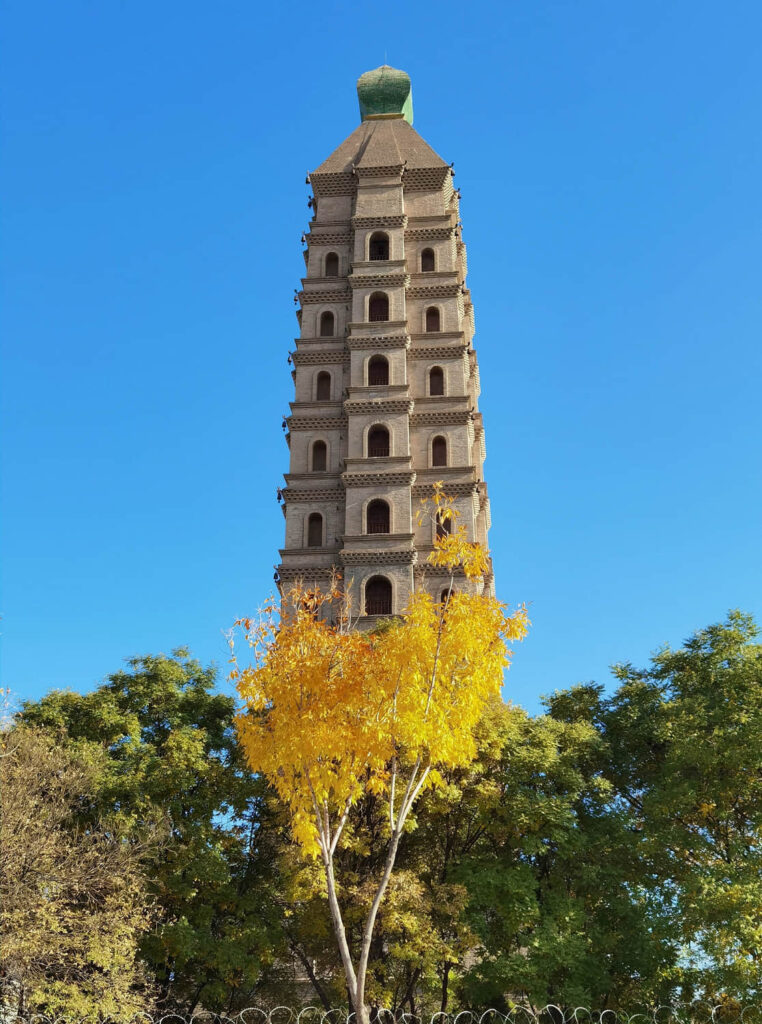
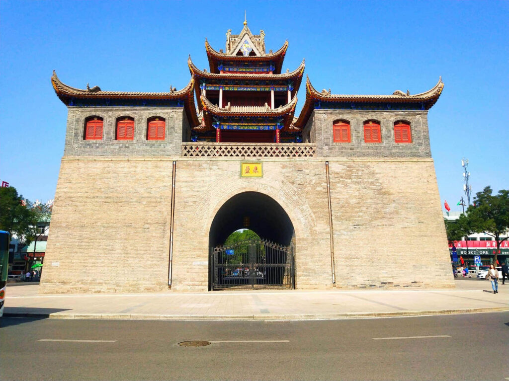
Xingqing District is the old city of Yinchuan, so there is a concentration of attractions, among which the Yuhuangge and Drum Tower, which are the center of the old city, are two places that travelers will not miss, and you can also look out over the brightly lit Yinchuan at night.
In addition, places such as Yinchuan Nanguan Muslim Dasi, Nanxiangmen, Chengtiansi Tower, and Haibao Pagoda Temple are all nearby and can be visited together when you have more time.
Or go to Shuidonggou, east of Hedong Airport, to see the earliest Late Paleolithic site in China as well as tour Hongshan Lake, the Ming Great Wall, and the Hidden Soldier Cave.
If you are interested in walking in the desert, you can still cross the Alxa Left Banner and Badain Jaran desert from Yinchuan to Ejin Jinnah, which is a well-repaired road due to the Alashan Heroes Meeting. However, if the weather is bad or the wind is strong, the sand of the desert will pile up on the road, so you need to pay attention to safety too.
Self-driving tips: Yinchuan city from Bayannur city about 312 kilometers, and a driving time of about 3 hours 50 minutes; the whole can take the Beijing-Tibet Expressway G6, over Wuhai and to Bayannur.
Jingxin dessert section
In this section, between Bayannur and Ejin Banner, in addition to the endless desert, there is only the conspicuous G7 Beijing-Ürümqi Expressway. On this highway, the Gobi Desert that swept by quickly in front of the eyes can sometimes be boring.
Second stop: Bayannur
Out of Yinchuan, on the highway, the front section will always see the Helan Mountains and the Yellow River, the landscape is also as people say the south of the border, however, as far away from Yinchuan, close to Bayannur, the south of the border scenery will also change to the desert scenery.
Bayannur. This city in the Mongolian language with a “rich lake” meaning, has always been a destination for travelers.
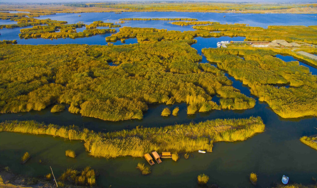
Whether it’s the Yinshan Mountains that stretch across the north of the city, the wind-eroded landscapes sculpted by billions of years of wind and rain, or the beautiful Ulansu Lake, the vast Wutra grasslands, are unparalleled scenery.
If you want to see the scenery of the Yellow River, you can go on the Yellow Highway S315 Dengkou all the way to Bayannur, if you do not rush, you can also go all the way to Baotou.
Bayannur to Ejin Banner can go all the way to the Beijing-Ürümqi Expressway G6, it is worth noting that the scenery along the way on both sides of the Gobi and desert-based, high-speed service areas are also very few, so it is best to fill up the gas tank before you get on the highway.
There have been many travelers who have encountered the problem of being halfway out of fuel, and in this section of the highway, the car does not have enough fuel or even out of fuel, and will face some difficulties.
Self-driving tips: Bayannur City is about 666 kilometers away from Ejin Banner, driving time of about 7 hours and 10 minutes; the whole process of taking the Beijing-Ürümqi Expressway G7, after Wuliji Sumu to Ejin Banner.
Third stop: Ejin Banner
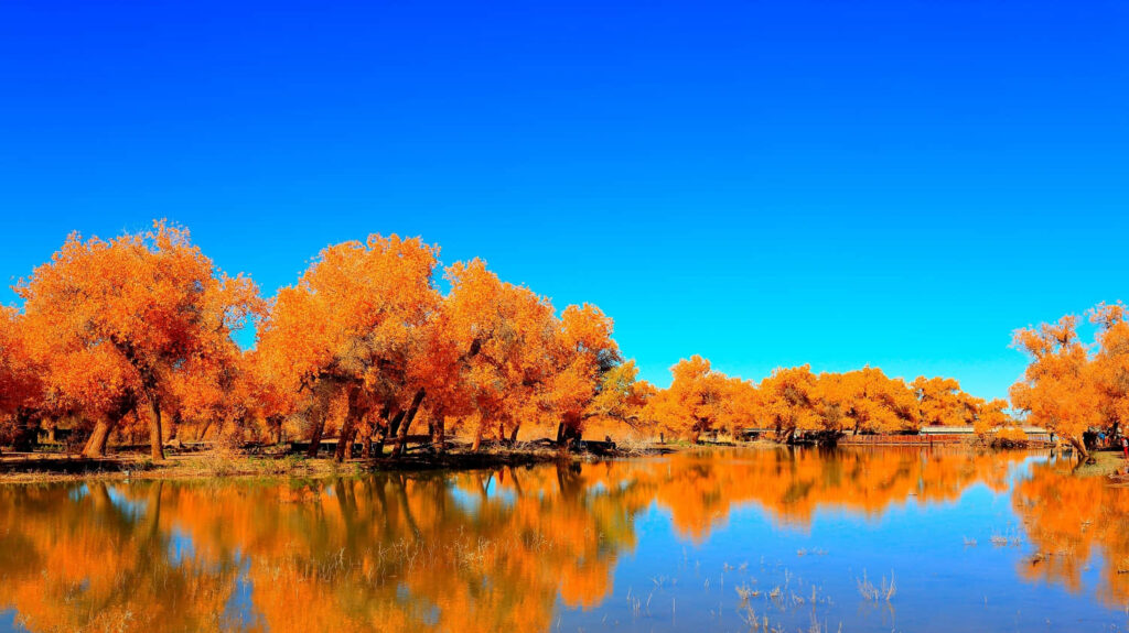
When autumn comes, the population density of Ejinna Banner rises rapidly to a breathtaking level, and the reason for this is the poplar forest, which contains some kind of magic.
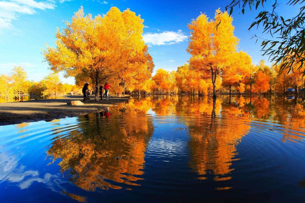
In the short month when the poplar is yellow, countless travelers flock to this town of 30,000 people at all costs, and in extreme cases, the town needs to receive more than ten times the usual number of people overnight.
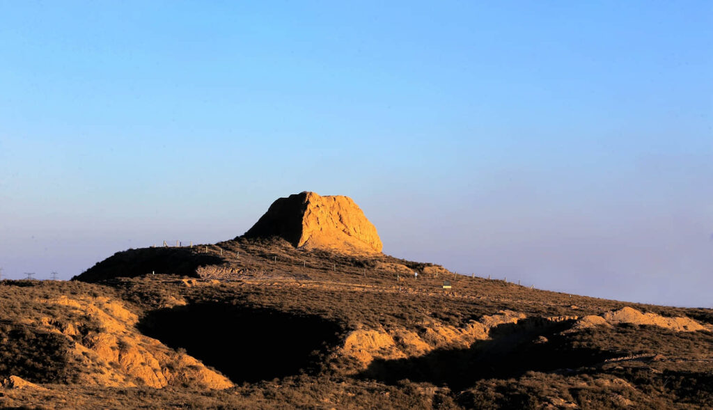
This, in turn, has led to the rapid development of the construction of the Ejin Jinnah Banner, as well as the opening of a number of well-established tourist routes. Of course, travelers are more willing to go to the few places that are famous, such as the Black City Ruins, the Strange Forest, the Poplar Forest tourist area, Datong City, Red City, Ga Shunnao’er, and Ceke Port.
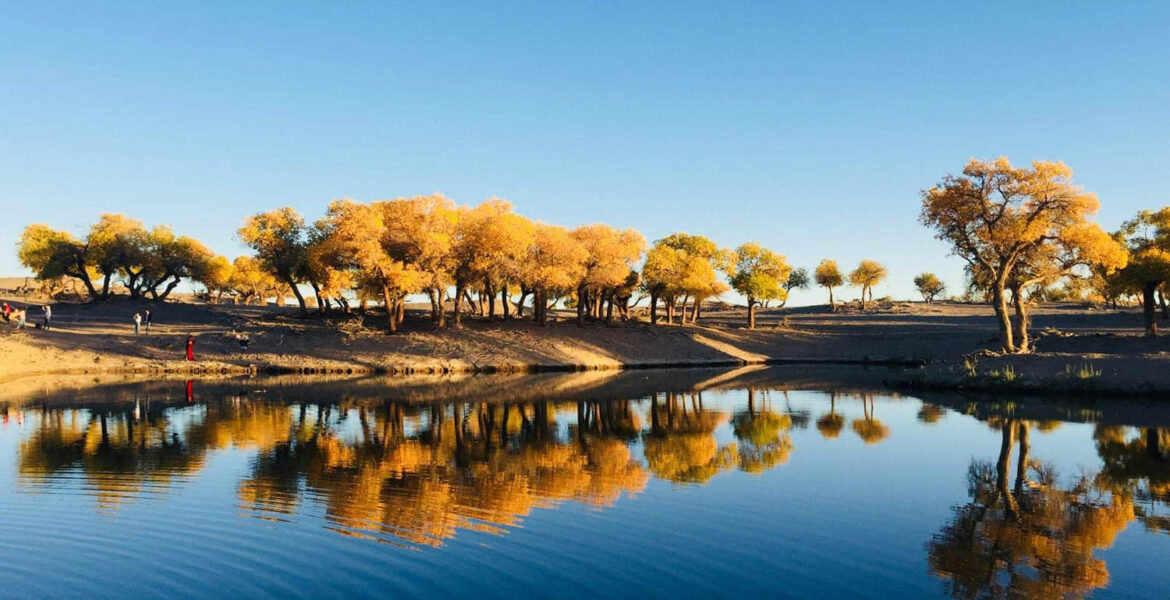
If you come just for the poplar forest, then the tourist area consisting of 440,000 mu of original poplar forest is a must-see. The golden poplar forest is strung by S312 and G331. From one bridge to eight bridges, these thirty kilometers of road are lined with stretches of poplar forest.
If you take S312, you will be accompanied by the Black River, and if you take G331, you will cross the poplar forest tourist area. It starts from a bridge reflecting the scenery of the poplar lake and ends at the eight bridges with the final desert scenery.
The Ga Shunnao’er was once the largest lake in the northwest region, the place where the weak water in “Three thousand weak waters, only one scoop to drink” was returned to, and the first settlement place of the Turks who returned east from the Volga River in Russia.
Driving tips: Ejinnak Banner is about 378 kilometers from Jiuquan City, and the driving time is about 5 hours and 40 minutes; take G213 south from Ejinnak Banner, pass through Dongfeng Space City, and then enter Jiuquan.
Hexi Corridor section
Above the vast area of the Hexi Corridor, the gorgeous natural ecological landscape, many cultural relics, and monuments are scattered, “desolate and desolate”, “South of the border” are generalizations about it, but in fact, this is not enough to show the full picture of this corridor.
Fourth stop: Zhangye
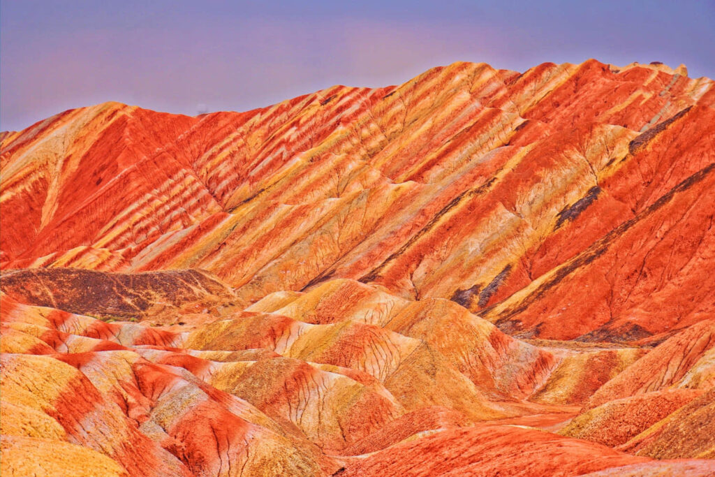
There are more places to play in Zhangye, but self-driving travelers generally go to two: Shandan Military Horse Farm and Zhangye Seven Colorful Danxia.
The Military Horse Farm is located in Shandan County and is a popular attraction in the west corridor of the river because of the large open green meadows and the galloping herds of horses.
The site of Heshui country is more than ten kilometers away from the city of Zhangye, where the weak water flowed through. The ruins are still proud despite the broken walls. If you want to feel the prosperity of the Silk Road and the Hexi Corridor, this is a good place to go.
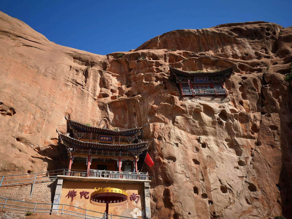
The cave art of Horseshoe Temple is a bit different from the four major caves in China, but if you leave the cave art aside, the natural scenery here will not disappoint you. Situated at the foot of the Qilian Mountains, it is blessed with lush green meadows, holy snow, and smoky mountain waterfalls.
Self-driving tips: Zhangye City is about 252 kilometers away from Wuwei City, and the driving time is about 3 hours; take G30 Lianhuo Highway or G312 from Zhangye to the east, and go to Wuwei after Yongchang County.
Fifth stop: Wuwei
When you come to Wuwei from Zhangye, it means you are about to go east out of the Hexi Corridor.
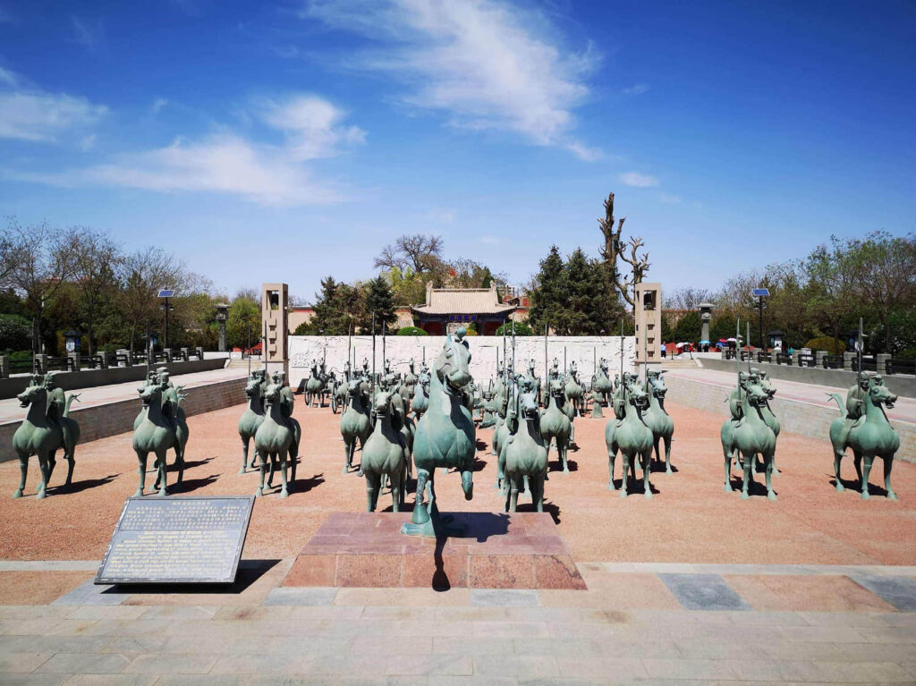
A famous cultural city, there is the first Confucian temple in the northwest – Weiwu Confucian Temple. If you are interested in Xixia culture, you should not miss the Xixia Museum of Wuwei.
Driving Tips: Wuwei City is about 271 kilometers away from Lanzhou City, and the driving time is about 3 hours and 20 minutes; take G30 Lianhuo Highway or G312 from Wuwei City, via Gulang County, Tianzhu County, Yongdeng County, and finally arrive at Lanzhou.
Sixth stop: Lanzhou
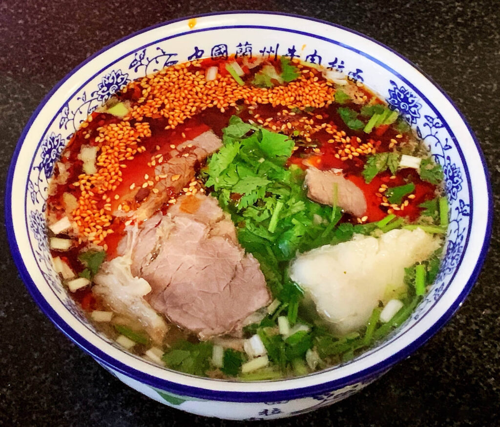
Whenever Lanzhou is mentioned, the word “ramen” always comes to mind, but Lanzhou people will often correct you: “It’s called Lanzhou beef noodles”.
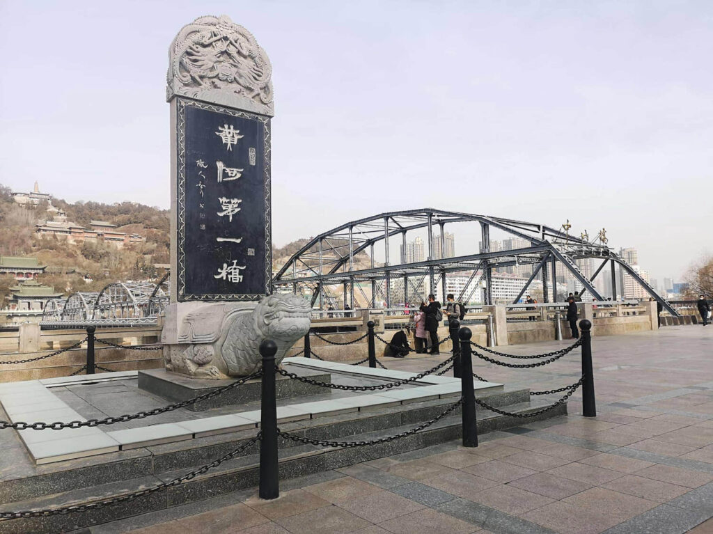
Lanzhou is the capital city of Gansu Province in Northwest China. The prefecture-level city, located on the banks of the Yellow River, is a key transportation hub and regional commercial center. The city is also home to a number of important historical and cultural sites. Lanzhou is a popular destination for tourists interested in exploring the history and culture of Northwest China. The city’s many museums and historical sites offer a glimpse into the region’s past,
The autumnal colors of the populus euphratica forest in Ejinna Banner are still the most beautiful in China, but only for a short period of 21 days.
The good thing is that the scenery is available every year and the route is classic enough, so it’s not too late to meet again next year.